Photographic Interpretation – Part 1
Photographic interpretation is the skill of identification and describing both natural and man- made geographical features and their inter relationships as they are shown on a given photograph of a given area.
A photograph is an image or likeness of an object or environment taken by a camera at a particular time in a given place.
Parts of a photograph
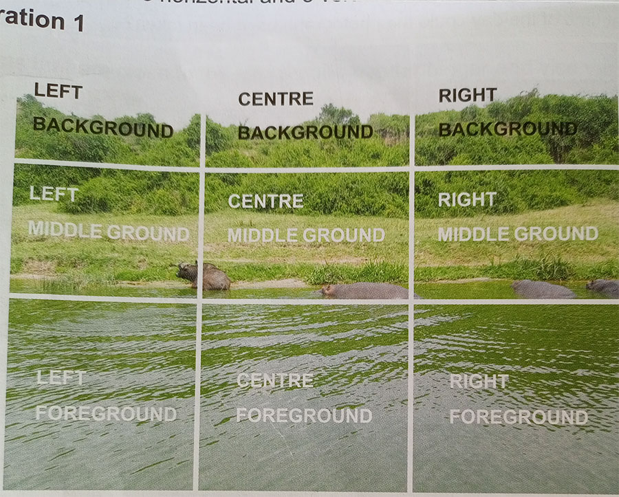
A photograph is divided into parts for easy identification and location of geographical features. It’s divided into three horizontal divisions. These include foreground, middle ground and background. It’s also divided into three vertical divisions which form the left, centre, and right parts.

The above illustrates the different parts of the photograph.
The foreground. This is the area nearest to the camera. Features in the foreground tend to be bigger and clear. The major economic activities are usually found in the foreground.
The middle ground. This is the part of the photograph between the foreground and background.
The background. This is the farthest part of the photograph from the camera. The features are much smaller because of perspective.
The horizon / skyline. This is the farthest distance in the photograph where the landscape or man-made features seem to meet the sky. However, not all photos show the horizon.

